Well for once a plan actually came to fruition. On the 10th May, we covered the 27 miles to Wismar under sail. It took us 6 hours as the wind was very light, but it was nice to make progress without the engine for a change.
The approach to Wismar is via a fairly narrow, dredged channel. First impressions aren't particularly promising – it is, after all, the commercial port that you enter – but the town itself is really quite attractive.
Wismar has been shaped by the Swedish Period as well as the much vaunted Hanseatic Period. It was occupied by the Swedes in 1632 and it wasn't until 1803 that it was ceded to Mecklenburg - with the right for redemption by Sweden after 100 or, as the case may be, 200 years.
On the evening of our second night in Wismar, we did a very unusual thing. The Roos invited us to join them for a meal at a local hostelry - and we did!
Yes. We actually ate out!
In the 15th century, brewing beer was the principal activity of the town of Wismar. In fact, records in the town's archives for 1464/65 attest to 183 breweries and 150 hop gardens.
This was the source of Wismar's wealth and paid for the large brick churches, amongst other things. Presumably the worshippers weren't Methodists or members of the temperance movement then!
The restaurant the Roos selected for us was situated in a brewery established in 1452. It still brews beer today and jolly good it was too!
 |
| Phil and Maree. And yes, they are real friends and not posed by actors! |
After 2 nights in Wismar we decided to move on to Rostock. The wind would be against us for part of the trip but it wasn't forecast to be particularly strong and the distance was only a little over 40 miles.
What sounds fine in theory, however, is not always great in practice. We covered the first half of the journey – the part where the wind wasn’t heading us - quite quickly. The remainder was something of a feat of endurance.
There was nothing remarkable about it; the waves weren't that big and the wind wasn’t that strong. It was just blooming uncomfortable as we rose up on one wave and crashed into the trough behind it over and over again…
Oh, that and the current turned against us at a rate of up to a knot.
Oh, and the fact that you can't sail directly into the wind but have to make progress towards it in a series of tacks (zigzags), increasing the distance you have to travel. Our 43 mile trip turned into 59 and took 12 hours! I hate beating to windward (and so does Jo!).
 |
| At last! We're in Rostock's harbour |
So it was with aching and creaking backs, joints, limbs etc. that we embarked on our exploration of Rostock the next day. Another town of the Hanseatic League, there are signs aplenty of its former prosperity. The photos tell the story best:
 |
| Neuer Markt square with St. Marien church in the background |
 |
| What was Royal Mail's slogan? "I saw this and though of Ju"? (Hi sis!) |
 |
| Central square with fountain of joy |
 |
| Part of the city wall from around 1300 and part of a former Cistercian convent |
 |
| Some flowers for my mum! |
 |
| I liked this mural. Especially the plugged in lighthouse! |
 |
| Lange Strasse. 1953 DDR era reconstruction into a parade street. Monumental buildings in Hanseatic style |
 |
| Useless signpost! |
 |
| They put some pretty weird stuff in churches! Inside St Marien's |
 |
| Rathaus (town hall). Looks like it's been turned into a bar! |
 |
| Jo being a cow at the Cow Gate |
 |
| and cleaning our fenders, sporting her new gloves! |
 |
| And finally from Rostock, a hot air balloon over the harbour |
We left Rostock for Stralsund just before 0600 on Monday 15th May. This was a trip of almost 65 miles, so we were expecting it to take around 13 hours. The wind was favourable but initially too light to use sail alone. It was also rather murky - not quite misty but threatening mist or fog. For the first few hours we saw nothing but grey sea and grey sky. The land, at a little over 2 miles distant, was hidden in the gloom.
 |
| Jo enjoying an exhilarating sail |
 |
| Just look at that view! We did, for about 5 hours... |
Fortunately, after about 4 hours of motor-sailing, the wind increased sufficiently for us to make good progress under sail alone.
Stralsund lies in a channel that separates the island of Rugen from the mainland. This channel is quite narrow as it winds its way between the sand banks, but it's very well buoyed so easy to follow - at least in daylight.
 |
| Sailing in the channel to Stralsund |
We opted to enter Stralsund's marina rather than anchor outside it and tied up in the almost empty visitors' area at about 1800.
 |
| The entrance to Stralsund's harbour |
 |
| Cyclone secured in the visitors' area of the marina |
The following day we set off to do some shopping and stock up on wine as we'd read that this was more expensive in Poland. We've yet to find out if that's true, but no point taking the risk, eh?!
Once chores were done, it was time to explore Stralsund - yet another Hanseatic League town (truth be told, we were getting a bit Hanseatic-ed out by this time!).
Our map mentioned the "Spektakular: Die moderne Architektur des OZEANEUMS" which I assume translates to "Spectacular: The modern Architecture of the Sea-life Centre". It turns out that this was the white thing on the front that I'd thought was a building site! At the risk of sounding a bit Prince Charles, what a carbuncle! Who on earth thought it was a good idea to put that monstrosity next to the lovely old brick buildings?!
 |
| Stralsund's front. Note hideous new development! |
 |
| So hideous I photographed it twice! |
Thankfully there were some unspoiled parts too:
 |
| Heilgeistkloster... |
 |
| ... which looked like this inside |
 |
| One of the remaining town gates |
 |
| The Alter Markt (old market square) with St Nicholas's church to the right |
 |
| An entrance to St Nicholas's Church |
 |
| St Johanniskloster |
 |
| Part of the above |
 |
| Er... less than sympathetic development of part of the town's wall! |
 |
| Fuel dock with opening times in plain view (when you zoom in) |
That last picture might seem a little out of place. After all, why would anyone include a photograph of a refuelling station on their blog?
Well, some people don't believe I give Jo full credit for her achievements. I've included this picture to prove that I do.
So here goes.
On 16th May 2017, Jo had an idea.
And it was a good idea!
(Regular readers may recall that she also had a good idea in 2015. On that occasion she devised a method of syringing my blocked ear at anchor in the Stockholm Archipelago, but let's not go there again!).
You see, the fuel dock can't be accessed by land and the nearest place you can get to it is still too far away to be able to read the opening times.
Enter Jo, who suggested I zoomed in on the camera, took a photo, and then zoomed in on the photo to read them. And you can see the result above. Opening times in plain view. Well done Jo!
2 nights at Stralsund was sufficient to explore it and, on 17th May, we set sail again - this time for Swinoujscie in Poland. We were quite excited by this as, whilst we'd visited Poland previously, we'd not done so in our own boat before.
Before leaving I had to return our shower access card to the office; purchase a new Camping Gaz bottle (you can't get Camping Gaz in Poland apparently) and fill up with fuel.
The marina office was due to open at 0730 and the nearby lifting bridge at 0820 (and not again until 1220). The refuelling dock, which we now knew also opened at 0730, was located between the marina and the bridge. Our departure clearly had to be carefully planned and slickly executed!
All was going well and by 0740 I was back on board with the Camping Gaz and deposit for the returned shower access card. Just the refuelling to go then. So, on with the engine...
... which chose this particular moment to refuse to pump cooling water through the exhaust!
This cannot be ignored as, without the cooling water, the engine would quickly overheat and, in a worst case scenario, the exhaust hose could catch fire.
So it was engine off and check the impeller (in the water pump). That was fine, so try again. Still no water.
Engine off again and check water strainer. I'd cleaned this so I knew it wasn't blocked, but maybe I hadn't put it back together properly? Strainer removed. Strainer replaced. Engine on...
... and we had water!
0750 and off to the fuel station.
Luckily there was nobody already refuelling so we were able to take on fuel straight away. Refuelling completed, we set off for the bridge.
Where we waited 15 minutes for it to open!
Ho hum. Maybe I should just chill out...
 |
| The 0820 lifting bridge allowing us out of Stralsund |
 |
| The island of Ruden which is surrounded by shallow water and right in our way! |
 |
| Sailing should always be like this. Sunshine and reasonable speed over flat water |
 |
| Lovely! |
Swinoujscie was supposed to be 54 miles from Stralsund but, as part of the trip was into the wind, we added 6 miles to that by tacking. It took us about 12 hours so I had plenty of time to practice pronouncing Swinoujscie. Apparently you say it "Shvin-o-oo-weesh-tah", so absolutely nothing like it looks (to an English person). I don't suppose I ever got it right, but my attempts seemed to amuse Jo!
 |
| The windmill at the entrance to Swinoujscie |
 |
| The docks on the eastern bank of the Swina |
After a good night's kip it was time to explore Swinoujscie.
We hadn't got our bikes out for a while and, as Swinoujscie is quite big, we thought this would be a good time to do it. So off we pedalled - to the amusement of Phil Roo (heard muttering something about me being in a circus...) - in search of a cash machine and some zlotys.
 |
| (Possibly) Pl. Stewianski. Pretty flowers wherever it is |
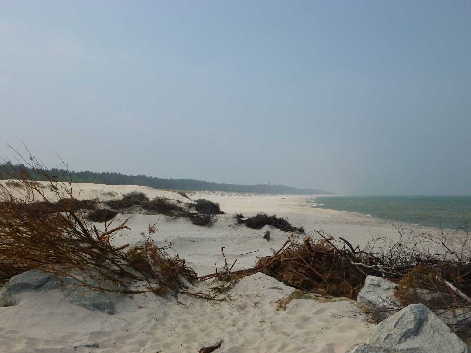
 |
| The long sandy beach that stretches to Germany |
 |
| Upmarket development just back from the beach |
 |
| Lighthouse. More of that later |
 |
| Fort Aniola |
 |
| Our marina. Can you spot Cyclone? |
 |
| A rather unfortunately named boat. And presumably there's a Stynka I too! |
We returned to Cyclone to write postcards before crossing on the free ferry to the eastern bank of the Swina and heading to the lighthouse. We seem to be drawn to climbing steps and, after several kms on our trusty steeds, we mounted the 308 steps to the observation platform. To prove it, here are our pictures from the top:
 |
| The exit from Swinoujscie's harbour |
 |
| Looking across towards the beach and Germany |
 |
| Looking up the river Swina |
Today has been a day of consolidation - which is a posh way of saying doing a few chores! Jo ran out of pants again yesterday (bikini bottoms to the rescue) so washing clothes was a priority. This can be really quite awkward when you speak none of the language and very little English is spoken by the marina staff.
In fact, we've been surprised how little English is spoken here. It's Poland, of course, so why should they speak English? But there are so many Poles in England who speak excellent English so we'd assumed it was widely spoken here. It's taught in schools apparently (Russian was before Solidarity) but then French is taught in English schools and there aren't many English linguists are there?!
Today is also tinged with a little sadness as Maree Roo must return to England for a while due to the restrictions applicable to Australian passport holders in the Schengen area. Hopefully we'll meet up with her again on her return and we're sure to see more of Phil in the meantime.
Have a good time in England Maree!